
In early June I came across a random blog post (http://www.yellowleaf.org/scramble/g/r/2015-08-21-mf-necklace.html) about a backpacking trip this woman had taken, starting on a Seattle City bus, deep into the Central Cascades. It seems that through a series of public transport options, she had gotten herself to a Middle Fork Snoqualmie River trailhead, with the intention of heading north east to meet up with friends at the La Bohn Gap. I had never heard of this destination so I began googling the name and found a scant number of references. Even the WTA did not have an official direction page. Eventually however, I was able to derive enough info and got it into my head that it would be one of the summer's fun goals, to reach this place.
In late July we tossed around the idea of heading down to the Sawtooth Mountains in Southern Idaho to be in the Toxaway Loop for the solar eclipse. After all, the path of totality ran directly through it, and what better place to be, I thought, than the mountains my folks took me hiking in every summer when I was wee lad living in Boise. I remember being in fifth grade there, when the moon crossed the sun's path, turning day to night briefly. As the date neared though, projections of biblical traffic jams, closed trailheads and camping headaches began to pop up on the internet. Reports had it that eclipse tourism had begun twelve years before with the most forward looking making their reservations at that time. Well nothing gets my blood up quicker than a traffic jam, inadvertently getting stuck in a sea of humanity, or even the possibility of it. My wife knows this about me too. We figured I'd make life miserable enough for the both of us, so we decided against heading for the Path of Totality. Instead, inspired by a lone blog post we headed for the East Fork Foss River Trailhead, which is the more typical route to reach the La Bohn Gap, and the abbreviated reverse of the Blogger's route. The trail along the East Fork Foss begins just outside Skykomish on Highway 2 and travels generally south along the mellow river valley for 5 miles. At five miles the trail crosses the Foss and heads up at a quite steep grade towards the Necklace Valley for three miles. The opening of the Necklace Valley is heralded by the tiny Jade Lake, which is dominated by (as is the whole valley) La Bohn Peak. We continued hiking, hoping for a campsite a little more open and closer to the Gap. We settled on the third lake up, Emerald Lake. It had a nice little campsite at the north end, with a little treed point that stuck out into the lake and a chorus of dinner time singing frogs. This brings us the point when I dug my camera out the next morning, which appropriately was Eclipse Day. I will now lean on the photos to tell the story.

This is a frog that Nicole named Vinkit. And here is Vinkit taking in the descending light as the moon begins transit across the sun. As the temperature descended, Vinkit came out of the water.

With the majesty and eerily metallic light of the eclipse behind us, we began climbing towards the Gap. The Gap is in the background and without snow, is the preferred route up. But the snowfield was steep enough to desire crampons, so we opted for the waterfall route; a semi scramble up the side of the waterfall coming down out of the La Bohn Lakes, that involved a lot of tree molestation to aid in ascent.

So I've jumped ahead a bit and will return to the La Bohn Lakes with photos that have better light. This is Mt Hinman Ridge. Left to right, the peaks are Bear's Breast, Summit Chief, Chimney Peak and Overcoat Peak. To the lower right is La Bohn Peak. I thought that if I made it up to this ridge, I would be looking down onto the Hinman Glacier, but realized quickly that the glacier sits on the north side of the Mt Hinman (The Snowcatcher), and that I was actually looking at its south face and into the Lake Rowena Basin. But this was a pretty damn rapturous view, so I could go home happy, with an added destination if we come again.

Heading back down from the ridge provided an epic view of the La Bohn Lakes and the Necklace Valley below.

On the shore of the first La Bohn Lake, getting eaten alive by mosquitos and getting a little rest before heading back down into the Necklace Valley for the night. That night, the wind shifted, and the smoke from forest fires near I-90 blew into the Necklace Valley. In the middle of the night I woke up with a start, thinking that a fire had jumped a few ridges and was bearing down on us. But stepping out into the night revealed lots of smoke blowing through minus any ominous glow, so I went back to sleep. In the morning we reluctantly began the long descent back down to the Foss River and onward to plan the remainder of the trip over a strange chicken dinner in Skykomish.

Any remaining qualms regarding the previous night's earnest fried chicken were quickly blotted out by this little Leavenworth milagro.

Nothing follows a gut bomb breakfast better than a pump track workover in 95 degree heat! This place is a blast and there should be one on every street corner nationwide. Leavenworth, WA
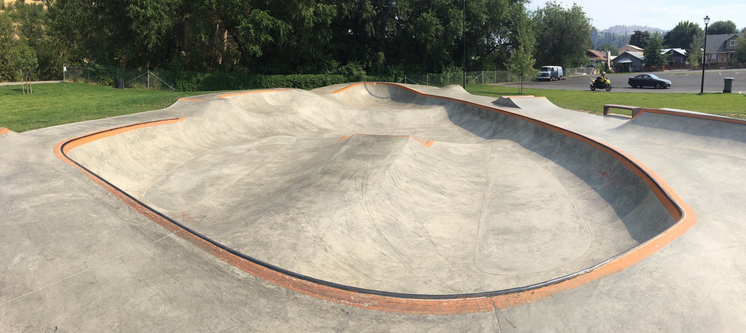
While waiting for our clothes to dry at the laundromat in Cashmere, we paid this little gem a visit. It's an Evergreen skatepark, and those guys make some killer stuff- and it was mercifully low attended that day, so very few kids had to suffer my over padded, under technical caveskating.

So we headed up to the Methow with clean clothes, to stay in our friend's cabin. This is a cool old fire lookout on the appropriately named Lookout Mountain.

Hiking the PCT near Windy Pass, in the Pasayten Wilderness.

Pepper demonstrates her ziplock techniques. Pinkies up and out.

Digz Yo. Off the grid and lovely.

A recreated example of early Methow people's shelter/communal area, in Twisp. Our friend Vic hides from the camera.

a Mazama swimming hole.

A thoughtful evening roll on the Methow River Road.

Eventually we had to leave our high Cascade ramble and come back to the demands of the city. One seeks to lose themselves in the deep forest trails, the cool smell of river fecundity, the swirls of constellations and spiraling granite. Padding down a trail does more for unveiling new ideas or finding clarity on existing ones than any conscious pursuit to do so. One last high spot before dropping back down to sea level was hiking up to the base of the Early Winters Spires, roughly two miles from Highway 20. These Cascades reveal much of their own making while other parts remain so obscure; but what one really notices while traversing all these different zones of them, is just how unique each zone is. One can tell much about the general age of a place merely by how broken down the rock is. Or how efficient glaciers carve rock by the voids they leave and the material they push. And how they have influenced the cultures that have moved through them for thousands of years. And there is so much that remains to visit.